


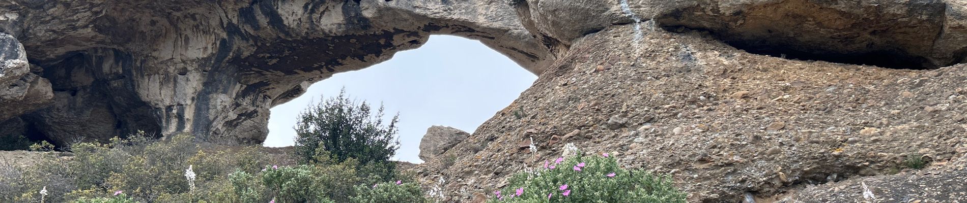
Bec de l’aigle / Sémaphore de la Ciotat

BerFran
User
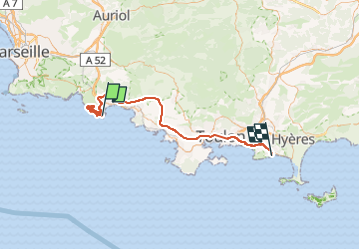

Length
70 km

Max alt
380 m

Uphill gradient
1267 m
Km-Effort
87 km

Min alt
2 m

Downhill gradient
1265 m
Boucle
No
Creation date :
2025-04-04 07:34:32.0
Updated on :
2025-04-04 15:37:44.603

FREE GPS app for hiking
 SityTrail
IGN / Geographical institutes
SityTrail Plus
The world is yours!
About
Trail of 70 km to be discovered at Provence-Alpes-Côte d'Azur, Bouches-du-Rhône, La Ciotat. This trail is proposed by BerFran.
Photos


Positioning
Country:
France
Region :
Provence-Alpes-Côte d'Azur
Department/Province :
Bouches-du-Rhône
Municipality :
La Ciotat
Location:
Unknown
Start:(Dec)
Start:(UTM)
711777 ; 4782759 (31T) N.
Comments